BIODIVERSITY CERTIFICATION DATA
Step1. Farmer Information
NAME:
Rajendra Kalpe
VILLAGE:
Ghatanji village
CROP:
Cotton
DNA:
GhTUB1
ADHAR NUMBER:
4148 9490 2458
LATITUDE & LONGITUDE:
20.133610037643702 78.26468728966594
Step 2&3. FARM AUDITING & OWNERSHIP
Physical Farm Auditing is done by using
IoT, Satellite and Drone
Validation of Farm Ownership
Farm
validated for
Rajendra Kalpe with document number 1899/2011/EC
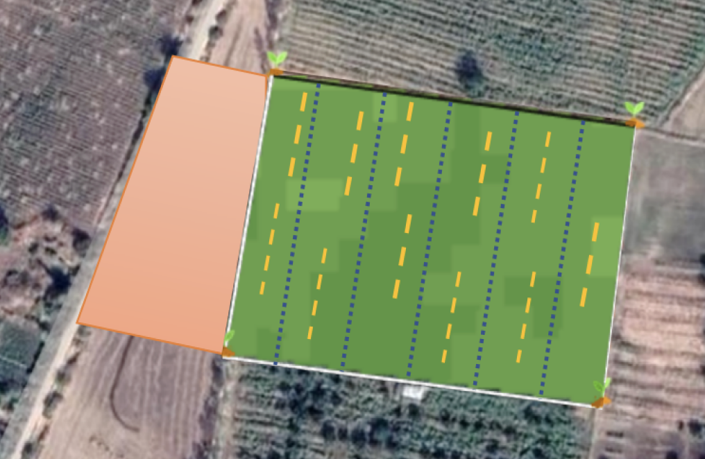
Step 10. BUFFER ZONE ESTIMATION
Buffer zone of
57 Feets was found between organic
crop and wheat

Buffer Zone represented in Brown color

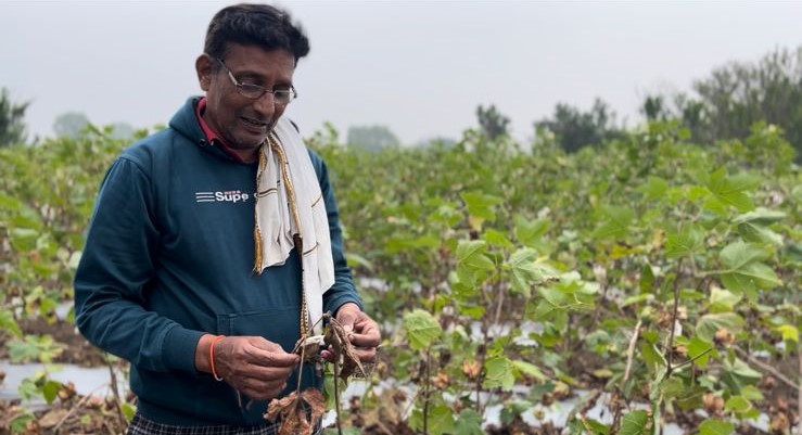
Farmer Image

Step 9. CROPPING SYSTEMS AND LANDSCAPE ANALYSIS
MAIN CROP:
Cotton
ROTATION CROP:
None
PARALLEL CROP:
Mustard
MIXED CROP:
Munga
SOWING:
June, 2023
HARVEST:
December, 2023
Step 11. WATER MANAGEMENT WITH SENTINEL 1C & 2A
Water used for irrigation in 5 months were : 3566 m³Step 12. YIELD ESTIMATION IN AGRICULTURE
Yield calculated : 6.2 T/ha, Total 32.6TStep 13. DE-CARBONIZATION & GHG CALCULATION USING SENTINEL-5 TROPOMI
GHG GASES ABSORBED
CO2:
11.18 tons
CH4:
4.6 tons
N2O:
3.8 tons
HFCs:
600 kgs
HCFCs:
450 kgs
The data is of village level, and the numbers are approximate numbers
Step 14. ORGANIC NATURE OF THE FARM AND BIODIVERSITY ASSESSMENT
ORGANIC FARM DEPICTED WITH FOLLOWING ALL THE PREVIOUS STEPS
BIODIVERSITY IMPACT
Increase in soil microbes :
14%
Increase in bees:
6.6%
Increase in butterfly:
12%
Increase in greater coucal:
1%
Step 6,7&8. GEO-REFERENCING, CROP IDENTIFICATION & LULC:
Geo-referencing using:
Sentinel-1A
Land Use History Analysis with:
Sentinel-1C and Sentinel-2A
Crop Identification with:
Sentinel 2B
Deforestation Detection:
No defeoresteation detected(EUDR compatible)
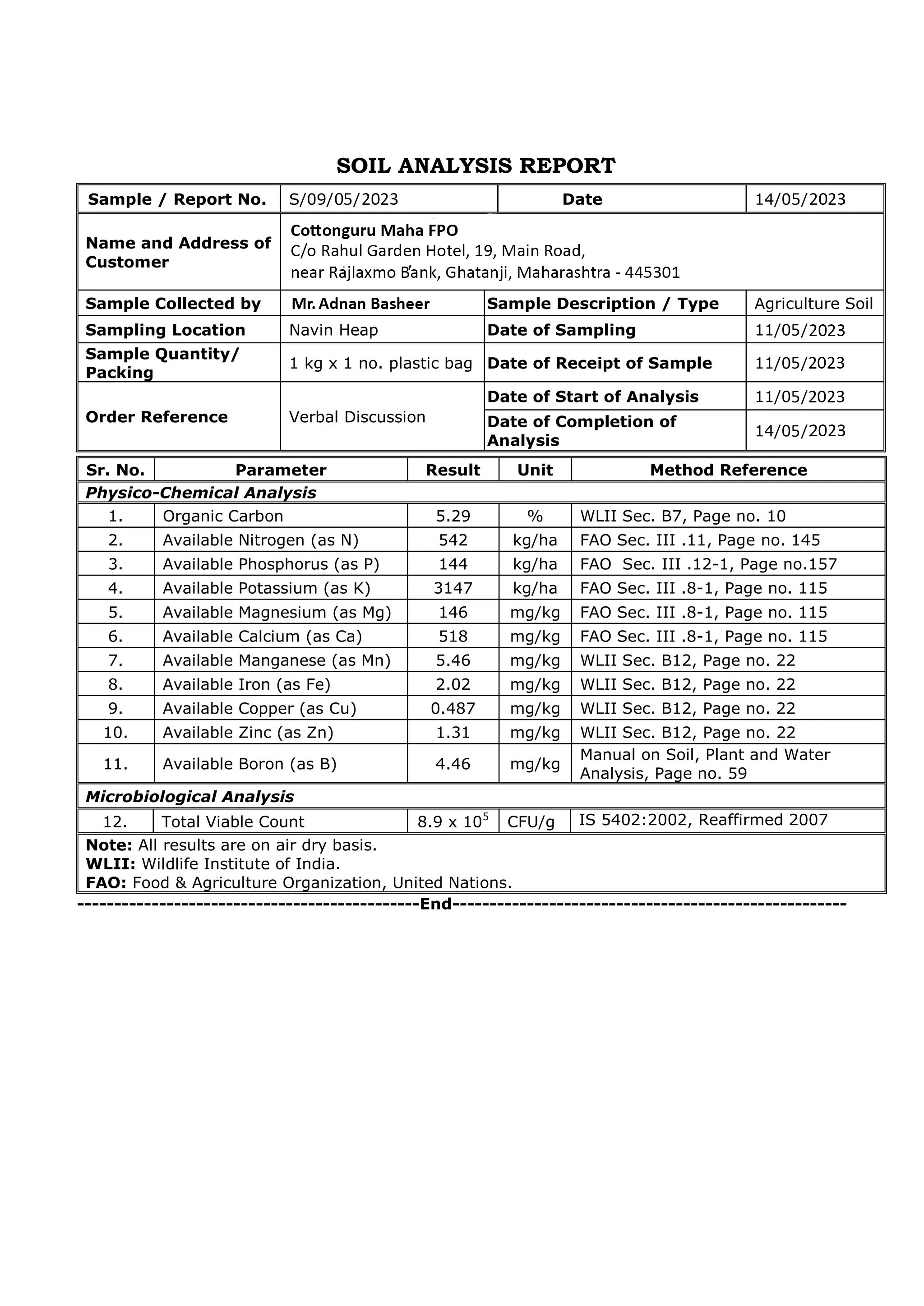
Step 4&5. SOIL TESTING REPORT
